
Blog, California, Destinations, North America, United States
Palomarin Trailhead to Alamere Falls: One of the Best Hikes in Point Reyes
May
Last updated on March 17th, 2022 at 09:26 am
Hiking to Alamere Falls in Point Reyes National Seashore had been on my hiking bucket list for ages! The two things holding me back from checking it off since returning home were the length and the fact that I was not in the best hiking shape (thanks COVID). That all changed on a windy, overcast day on May 1st when a friend and I made the 12-mile trek from the Palomarin Trailhead to Alamere Falls.
After completing the Alamere Falls hike, I can confidently say that it ranks in my top ten favorite hikes, which include the Salkantay Trek and the Quilotoa Loop. This hike proved to me once again that you don’t need to travel far to be amazed at the beauty of this world.
In this post, I’m going to share with you all of the things you need to know about hiking to Alamere Falls.
This post contains affiliate links, which means that, at no additional cost to you, I will earn a tiny bit of income if you decide to make a purchase or booking. For more, check out my disclosure.
Alamere Falls Hike Overview
Alamere Falls is a waterfall that flows directly into the Pacific Ocean. Cool, right? That’s what placed this hike on my bucket list.
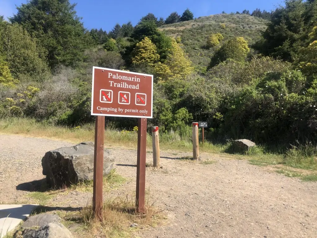
There is no actual Alamere Falls trail. There are a few trailheads that lead you to Alamere Falls, and I’ll be sharing with you the way I did it, and what seems to be the most common way, via the Palomarin Trail.
Keep your eye out for poison oak (especially if you take the shortcut) and check yourself for ticks.
Alamere Falls Hike Length (via the Palomarin Trailhead)
The hike to Alamere Falls from the Palomarin trailhead is 6.5 miles (one-way) along the Coastal Trail. It is a well-marked and well-worn trail, so you shouldn’t have any problems.
In blog posts about this hike and referenced in the comment section of All Trails, you’ll see notes about an unofficial shortcut to the falls. This shortcut shaves about 2 miles off of the hike, one way. So if you took it in both directions, this hike could be 8 or so miles. Please note that this shortcut is not sanctioned nor maintained by the National Park Service.
We did a combination of this. We hiked the entire way, 6.5 miles to Alamere Falls, without taking the shortcut. I thought it would be nice to see the entire trail and witness the falls coming into view from the beach. Plus, all of the comments said the hike down to the falls from the shortcut was sketchy and I didn’t want to get stuck or hurt.
We decided we’d gauge what the shortcut looked like from the bottom and decide if we wanted to take it back. Ultimately, we did end up taking the shortcut back and I can attest it was super sketchy. It’s a complete vertical with loose, sharp rocks. I would not want to climb down it, but going up, while scary, wasn’t so bad.
Following the trail in this manner, made the hike about 11 miles long.
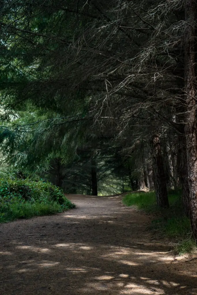
Other than this shortcut, the terrain of the Palomarin trail is mostly flat, with some rolling hills. It’s a pretty varied terrain as it starts with coastal views, then goes under the Eucalyptus trees, and along the beach. In some sections, there are larger loose rocks and in others, there are tree roots, so you’ll have to watch your step.
Alamere Falls Hike Time
We started the hike around 10:00 am and made it back to the car around 3:00 pm. This included a rest stop at Bass Lake, a lunch break at the Wildcat campground, and spending some time at the beach near Alamere Falls.
Check the Tides
Make sure to check the time for high tide before attempting this hike. The waves can make this an extremely dangerous hike! If you get to Wildcat Beach and notice the waves are hitting the bluffs, do not attempt the rest of the hike. Come back at a later date.
Alternative Hiking Trail Options to Alamere Falls
Hiking the Coastal Trail via Palomarin trailhead is not the only way to access Alamere Falls. Here are other trails you could also follow to the falls that start near the Bear Valley Visitor Center.
- Bear Valley Trailhead: 7.3 miles to Alamere Falls
- Five Brooks Trailhead: 7.1 miles to Alamere Falls
For more information on these hikes, check out this website.
Restrooms & Water
There are vault toilets at the Palomarin trailhead parking area and Wildcat Campground. There were no water sources at either location, so bring your own.
Getting to the Palomarin Trailhead from San Francisco
The drive from San Francisco to the Palomarin Trailhead is about 2 hours. It’s a beautiful drive through Mt. Tamalpais and Point Reyes. It is a pretty windy road, with lots of cyclists, so if you get motion sick, prepare for that.
Also, fair warning, the last mile of the drive is an unpaved gravel road. We did not know this and definitely would’ve taken a different car!
The Palomarin trailhead parking lot is limited. You can park on the side of the gravel road and there is an overflow lot about ¾ mile down the gravel road (you’ll pass it on the way in).
We arrived around 10:00 am and were the 8th car parked on the side of the gravel road. When we returned at the end of the hike, around 3:00 pm, the lot had emptied significantly, but there were cars far ahead of us on the gravel road.
This is a very popular hike in Point Reyes. If you want to ensure that you get a parking spot in the lot, get there before 9:00 am, I’d say.
Hiking to Alamere Falls
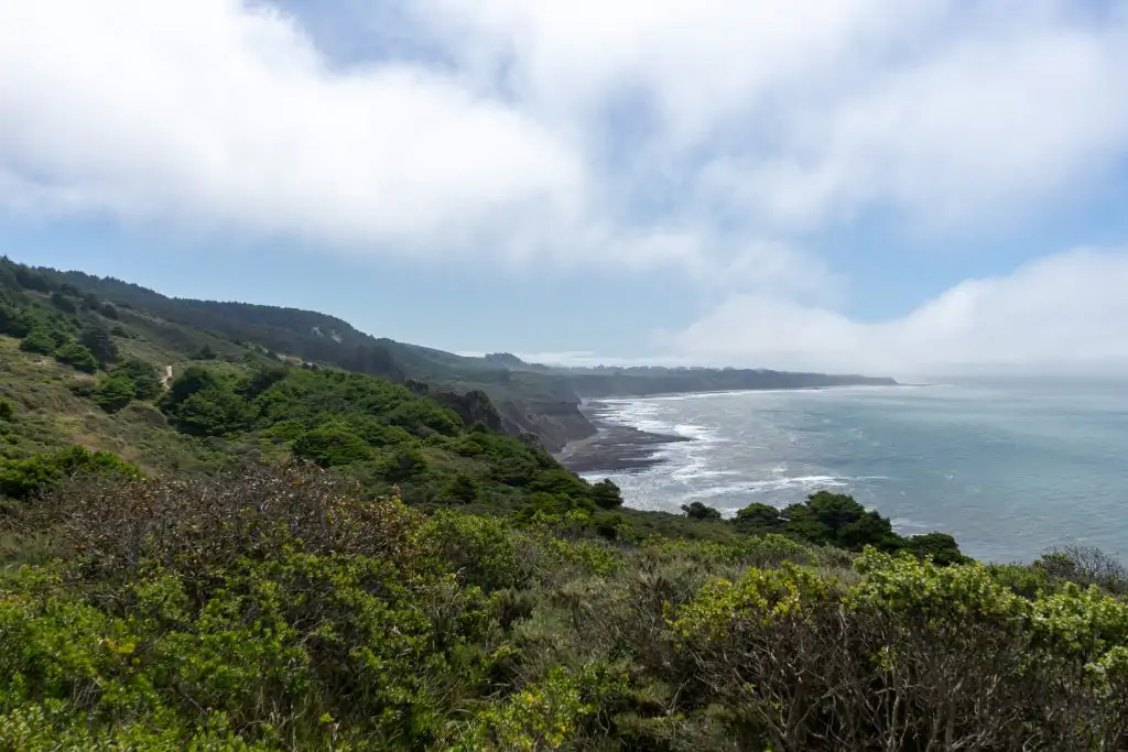
The thing that I loved the most about the Palomarin trail, is the variety of landscapes along the way to Alamere Falls.
The trail starts along the coast which offers amazing views of the cliffs and the Pacific Ocean. If it’s windy on the day you go (like it was for us) this will be the windiest section of the trail.
It then cuts into the hills through a Eucalyptus grove and is covered by the trees for the next 4 miles.
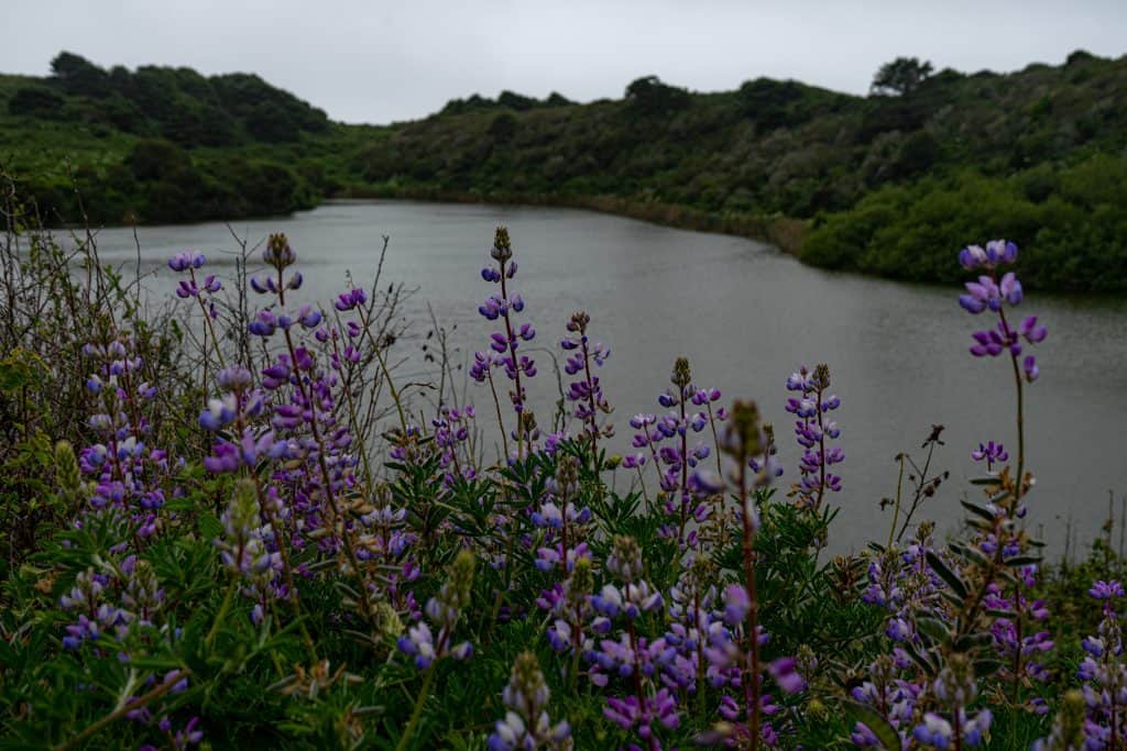
Bass Lake
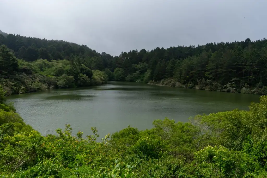
About 2 miles into the hike, you’ll pass Bass Lake. There is a small, and short, trail that will lead down to the lake. There’s not much of a “beach” next to the lake, but there is a small clearing in the trees where you can sit to rest and enjoy a snack.
The Shortcut
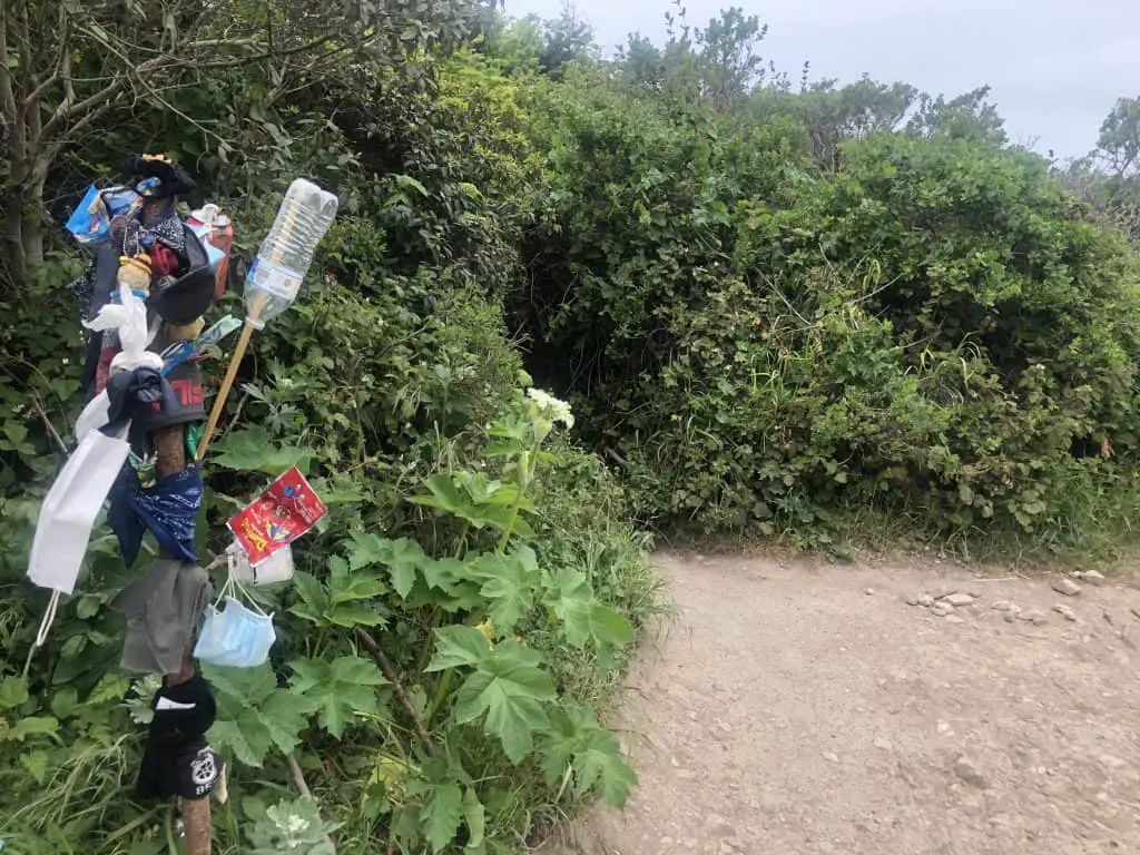
Roughly 2 miles later, you’ll reach the unofficial shortcut. There is a branch in the ground with a FILA sandal, flags, and masks, that marks the trail. If you’re going to take the shortcut, this is where you’ll turn.
Wildcat Campground
If you opt-out of the shortcut, like us, it’s about 2 more miles to Wildcat Campground. You’ll see two trail options to get there: Ocean Lake and Coast Trail. They’re both the same length and we opted to stay on the coast trail. If you’re doing the complete loop (skipping the shortcut) you could do the other side on the return.
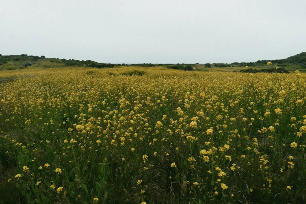
I have to admit, seeing Wildcat campground come into view covered in yellow spring wildflowers was simply stunning. Here, there is a bathroom and picnic tables (if campers aren’t there). We ate our lunch at one of the vacant picnic tables surrounded by wildflowers. It was epic!
Wildcat Beach
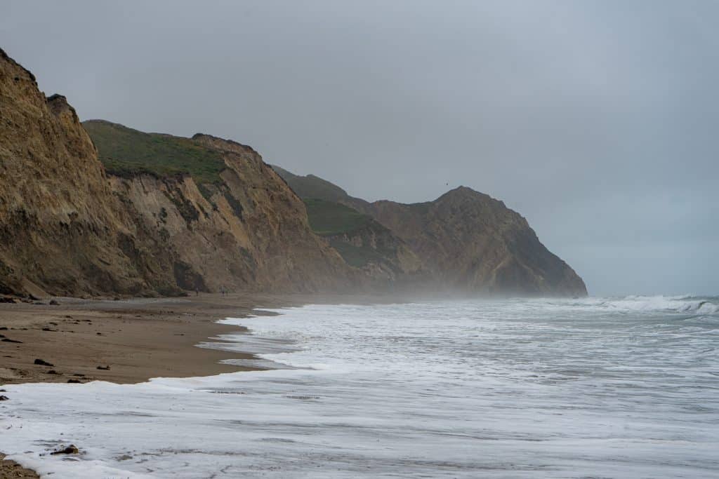
The hike then continues for one mile along the beach. Walking in the sand is extra challenging. I recommend getting to wet sand as it’s more stable, but watch out for incoming waves (perks of waterproof hiking boots).
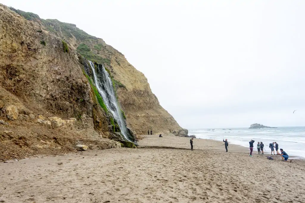
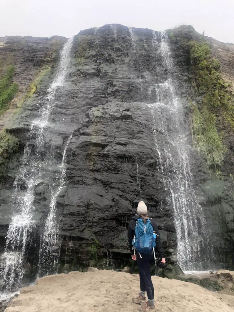
Alamere Falls
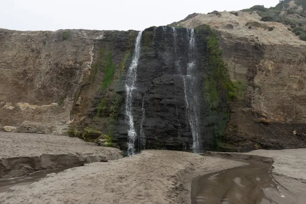
At the end of the beach, Alamere Falls will come into view. The strength of the waterfalls depends on the amount of rain California is getting. Which, right now we are entering another severe drought so when we visited, it was considered “small”. But the cool thing when it’s small is you can get right under it and feel the spray from the water, which is pretty magical.
Spend as much time as you’d like here. The beach is beautiful, even on an overcast day. It’s a pretty great snack spot!
The Shortcut
At this time, you’ll decide whether or not you want to take the shortcut back up and shave off a few miles. If you’re looking at the falls, the shortcut is to the left. You’ll see people climbing up and down it.
What convinced me that I could do it was:
- I saw a girl in Birkenstocks doing it (100% do not recommend)
- I wanted to shave off some miles
Here are some tips for the shortcut, if you’re going to do it (again this is not recommended by the parks or I so don’t come at me ok). If someone is coming up behind you, make sure they give you space. I accidentally kicked loose, sharp rocks into my friend’s face. The people coming down have the right of way, try to time your climb up for when people are not coming down because there’s not a lot of space for two people. And finally, take your time. If you start it, you can always stop and go back to the sanctioned route.
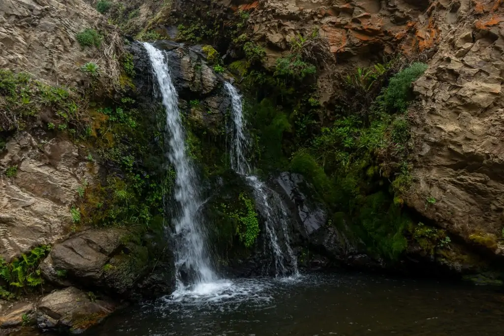
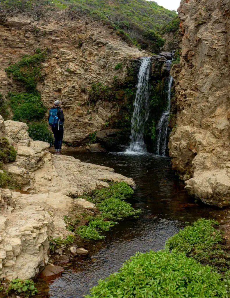
Upper Falls
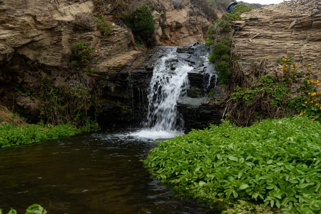
What I wasn’t ready for was the fact that above the main waterfall are THREE other waterfalls. If I’m being honest, the upper falls are even more gorgeous than the main waterfall. So if you wanted to, you could take the shortcut just to this point, and not do the sketchy part down to the beach. I highly recommend spending some time in the upper falls.
The Rest of the Coast Trail
From the Upper Falls, there are a few more scrambling-type scenarios, none as sketchy as the one down to the beach. And then it levels out and becomes a nice trail back to the coastal trail.
From the shortcut, it’s about 3 miles back to the parking lot!
What to Bring on the Alamere Falls Hike
You’ll want to take everything on my short hike packing list. But here’s an overview of everything I packed in my amazing 22 L Osprey hiking backpack with tons of pockets for snacks.
- Sunscreen
- 2 L water bladder & Hydroflask. There isn’t anywhere to fill up along the way (I didn’t use all of it, but it was an overcast day).
- Snacks: apples, dried fruit, Peanut M&Ms
- Lunch: deli sandwiches
- AllTrails map downloaded offline (available for pro members)
- Power bank & charging cord
- Camera & spare battery
What to Wear Hiking to Alamere Falls
Wear anything you’re comfortable hiking in for 11 miles! When it comes to the clothing for this hike, layers are important. It was overcast and windy on the day I went which may not be the case for you. Plan accordingly.
Here’s what I wore
- Baseball hat (highly recommended some sort of hat)
- Workout clothes
- Long leggings & long sleeve shirt were worn 90% of the time
- I added on a sweatshirt and windbreaker during lunch and for the beach walk, I removed this after the falls on the way back to the car.
- Darn tough hiking socks (my absolute favorite, they keep my feet blister-free!)
- Keen hiking boots (they’re waterproof and I love them)
Things to do Nearby
Point Reyes National Seashore has a ton of things to do and explore. There are a wide variety of hiking trails, beaches, wildlife, and wineries to see here. I highly recommend spending a day or two exploring this area.
Here are a few of my favorite things to do in Point Reyes (or things that are on my list!)
- Take pictures at the Cypress Tree Tunnel – get that IG game going!
- Tomales Point Hike: another long, but stunning hike in Point Reyes
- Chimney Rock Hike: This is a great short hike that leads to a beautiful overlook of the ocean
- Elephant Seal Overlook: Just down the way from Chimney Rock is where Elephant Seals come to mate! Super cool to check these animals out!
- Shipwreck: this is on my photography bucket list!
- Tomales Bay Kayaking: also on my bucket list is kayaking in Tomales Bay
- Head to Muir Woods to explore the Redwood Forest
- Take a ferry and spend the day on Angel Island
Where to Stay Nearby
If you’re planning on making this more than a day trip from San Francisco, check out these awesome places to stay in or near Point Reyes.
- Wildcat Campground: You can camp one mile from Alamere Falls at the Wildcat Campground. It’s a small campsite, you’ll hike into it and need to bring everything you need, but it looks pretty awesome. I checked into reservations and it’s booked out for 6 months so if you want to camp here, plan. Check rates and book here
- Olema House Point Reyes: This hotel is situated in a wooded area in the small town of Olema, right near Point Reyes Station. The rooms look gorgeous! Check rates and book here
- Osprey Peak: This is a super rustic and charming 3 room Bed & Breakfast in Inverness which is near Tomales Bay, and of course Point Reyes. Check rates and book here
- HI Point Reyes Hostel: There’s an awesome-looking hostel located in Point Reyes. Due to the pandemic, they’re only accepting group bookings so it’s not exactly the cheapest option. Unless of course you have a group of 10 and are splitting the bunkhouse. Still, it’s worth checking into as we move beyond the pandemic. Check rates and book here