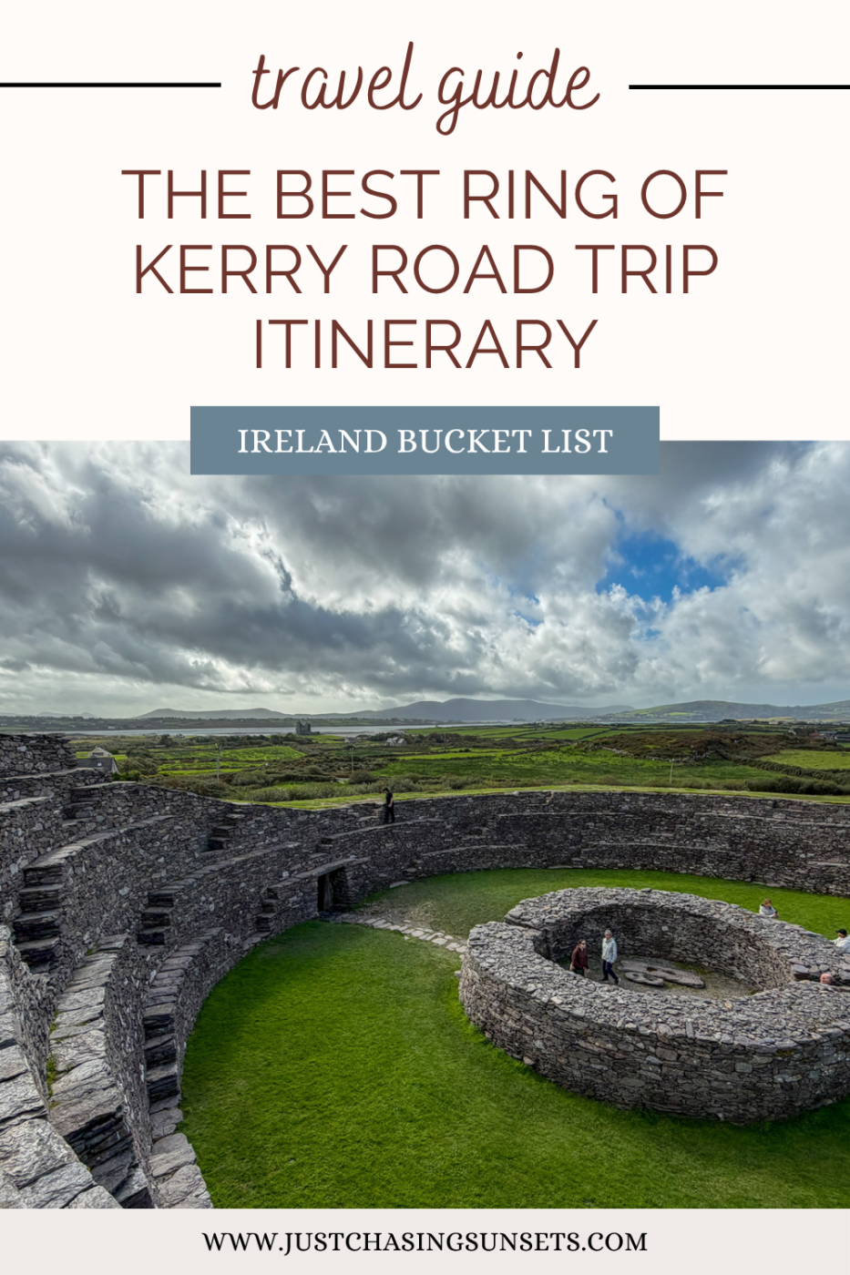
3 Day Ring of Kerry Itinerary with Skellig Ring
Last updated on November 4th, 2026 at 06:40 pm
The Ring of Kerry scenic drive had been on my Ireland bucket list for eight years, and in September 2026, I finally got to experience it! I spent seven slow days driving from Killarney to Dingle via the Ring of Kerry and the Skellig Ring, stopping at beautiful places like Derrynane Beach and the Kerry Cliffs.
You probably don’t have a week for this road trip, and that’s okay. Having the time to explore slowly helped me figure out which stops were worth lingering at and which I’d skip on a tighter schedule. I’ve distilled that experience into a 3-day Ring of Kerry itinerary that covers the highlights without turning the drive into a race.
This itinerary is especially helpful if you’re driving solo. I know how tiring it can be to navigate narrow, unfamiliar roads while deciding where to stop next. So I’ve organized the route into three manageable driving days, with estimated time at attractions and optional stops you can skip when you’re tired.
I’ve also plotted all the stops in this itinerary on a Google Map, so you can download it and have the entire route ready to follow.
This post contains affiliate links, which means that, at no additional cost to you, I will earn a tiny bit of income if you decide to make a purchase or booking. Please read my disclaimer for more information.
How Many Days Do You Need to Drive the Ring of Kerry
I spent months planning my Ring of Kerry itinerary, with the help of a local friend. I had plenty of time for this portion of my itinerary but still wanted to make the most of it, lingering if I wanted without feeling rushed to the next destination.
Also, since I did this toward the end of September, I knew daylight would be shorter than during the long summer days.
I also really wanted to do a boat trip out to the Skellig Islands. So I gave myself buffer time in case it got canceled, and I had to move it to a different day.
Ultimately, I spent 2 nights in Killarney, one night in Kenmare, one in Waterville, three in Cahersiveen (which was one night too many). The final day, I continued to Dingle instead of returning to Killarney.
I chose three nights in Cahersiveen because one day was supposed to be a full-day landing tour of Skellig Michael, which was canceled for the rest of the season because of the weather.
I used that day as a rest day in Cahersiveen before continuing to Dingle, which came in super handy since I was tired after four days of driving!
But you can do the same thing without spending seven days!

Is Three Days Enough?
After spending a week driving the Ring of Kerry, Skellig Ring, and Valentia Island, I think 3 days is the sweet spot for this bucket-list road trip. It’s enough time to stop at the highlights and even linger at a few!
It’s basically what I did once I left Kenmare, if we ignore the three nights in Cahersiveen!
But if you want to do a landing tour or eco tour of the Skellig Islands, you will need to add a day.
Here’s what makes the most sense for your travel style.
Three days: Best for seeing the major stops and enjoying the route without rushing. It fits well into a larger Ireland road trip itinerary.
Four days: Best if you want flexibility for a Skellig Michael boat tour (these cancel frequently, so give yourself a buffer. The landing tour requires a full day, whereas the eco-tour requires about 2.5 hours)
More time: Listen, if you have more time available, use it! It creates a buffer for bad weather days, and with good weather you can do more hikes, excursions, or simply enjoy this beautiful corner of Ireland.


Can You Drive the Ring of Kerry in One Day?
I REALLY DO NOT RECOMMEND driving the Ring of Kerry in one day. There is simply too much to see that you won’t actually enjoy it, especially if you want to see the Skellig Ring (where the best views are).
If you’re driving solo, it can also be dangerous because these roads are tiring to drive! You have to really concentrate to navigate unfamiliar, winding, narrow roads safely. Then add deciding where to stop, for how long, and how much daylight you have left… It’s a lot!
If you are like Katie, that’s all well and good, but I don’t have a week to drive this route leisurely; then I hear ya. Book a day tour then.
That is the only way I’d suggest a solo traveler see the Ring of Kerry in one day. Save the money on the rental car, and just book a day tour.
With a day tour, you can sit back, relax, enjoy the views, and let the driver figure out where to stop and for how long.
Not all Ring of Kerry day tours include the Skellig Ring because big tour buses can’t drive those roads. If the Skellig Ring is a priority, look for smaller tour groups and ensure that your tour stops at the locations mentioned on day two of this itinerary.
Here is a well-reviewed Ring of Kerry Tour with good stop options along the route.
If you’re traveling with someone else and can switch off driving because you’re both on the car rental insurance, and you’re adamant about doing this in one day, then here are my suggestions.
- Only drive the Ring of Kerry in one day during the summer months, so you have ample daylight to see everything and stay safe on narrow country roads or while navigating the very windy Moll’s Gap.
- Start in Killorglin so you can see the best of the Ring of Kerry and Skellig Ring at the beginning of the day when you’re fresh.
- Be discerning about where you’re stopping. With such a tight timeline, you won’t be able to stop everywhere. Pick one stone fort and a couple of beaches. I’d prioritize Cahergal Cashel, the Kerry Cliffs, and Derrynane Beach.
What Direction Should You Drive the Ring of Kerry
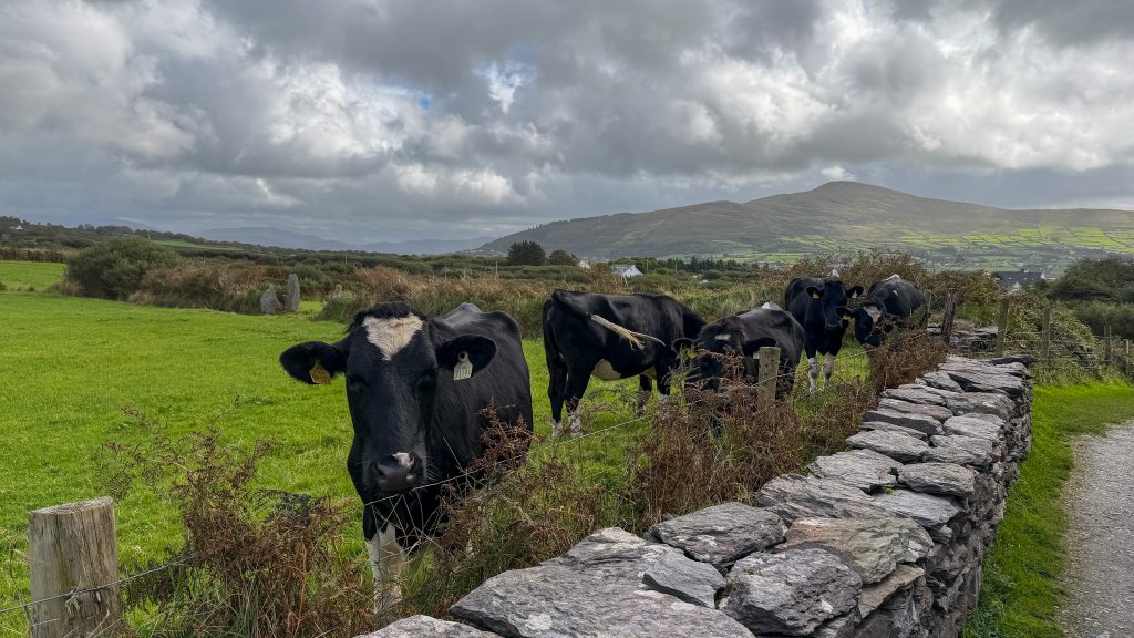
The number one question I had when planning my Ring of Kerry route was which direction to drive. Blog articles offered lots of opinions, but they were confusing and didn’t really help me decide.
Ultimately, I chose to drive the Ring of Kerry clockwise because Dingle was my next main destination, so it made logistical sense. I also didn’t mind facing tour buses head-on, and I didn’t really have that problem until the last day of the trip, when I was driving toward Dingle from Cahersiveen.
Don’t overthink this part; just decide what makes the most sense for your overall itinerary and then start planning. Let’s keep it simple.
If you’re continuing to Dingle, then drive clockwise.
If you’re coming from Dingle, then drive counter-clockwise.
If you want to overthink it, here’s more information about the pros and cons of each direction so that you can make the most informed decision for you.
Ring of Kerry Clockwise Route
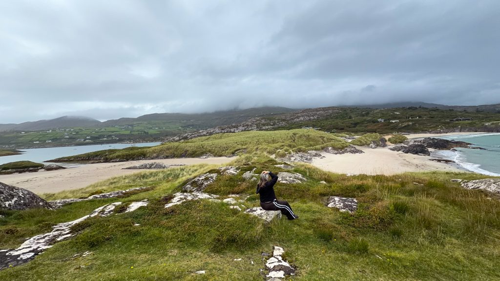
The clockwise route for the Ring of Kerry departs Killarney for Kenmare and ends with Killorglin. If you drive this way, you’ll be on the cliff side of the road, making it easier to pull over at viewpoints.
It’s also a good direction if you’re continuing to Dingle and not returning to Killarney.
Tour buses will be going in the opposite direction, so that you will face them head-on. This may cause a jolt to your system as you round a corner and come face-to-face with a tour bus.
The best views of the Ring of Kerry don’t really start until you leave Sneem, with the highlight being the Skellig Ring, which comes a few hours into the drive in this direction. You may be tired by the time you get to that portion.
Ring of Kerry Counter-Clockwise Route
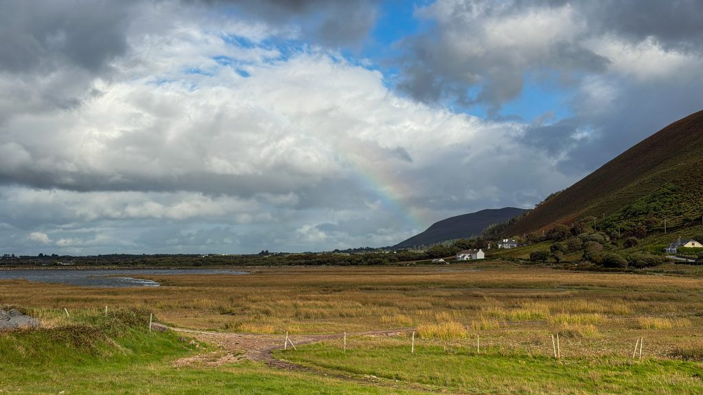
The counter-clockwise route departs Killarney for Killorglin and ends in Kenmare. This direction makes the most sense if you’re coming from Dingle and heading towards Killarney.
Tour buses drive this way, so you may get stuck behind them or pull off at the same spots, which can mean getting stuck behind a slow-moving vehicle and facing crowds at popular stops.
The best views are between Killorglin and Derrynane Beach, so you will be fresh to enjoy them! After leaving Derrynane, you can relax a bit because there’s not much more to see.
Since I drove the route clockwise, my three-day itinerary reflects that route. You can download this Google Map that I created for your drive. It includes all of the stops listed below!
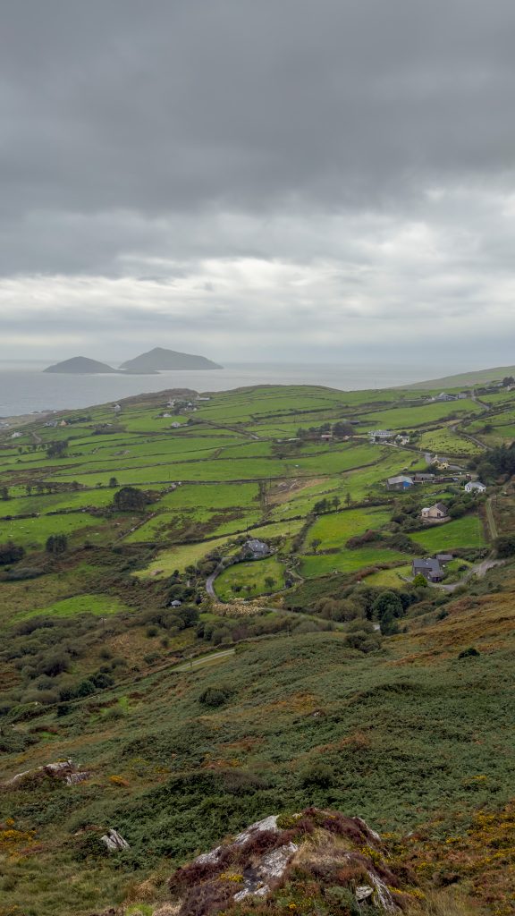
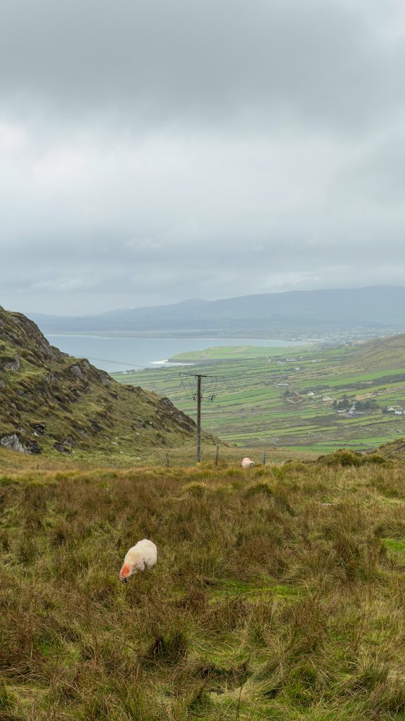
3 Day Ring of Kerry Itinerary Overview: The Clockwise Route
If you just want a quick look at what your 3-day itinerary will look like and how much time to budget for each stop along the way. We’ll get into details in the next section.
Start driving each day by 9:00 am so that you can make the most of a full day!
Day One: Killarney to Waterville, spending the night in Waterville.
Day Two: Waterville to Cahersiveen, spending the night in Cahersiveen
Day Three: Cahersiveen to Dingle, spending the night in Dingle (or Killarney)
Here are the main stops each day of the trip, along with the estimated time you’ll need at each one. Please know that these are estimates and don’t include the driving time between stops.
You may move faster than me, or slower than me. I love walking at least a portion of every beach I pass; you may not! The most important thing is that you prioritize what interests you.
I know one person whose priority was to stop at every pub possible on the route! The route is yours to explore as you like!
If you like what you see here, make sure you download the Google Map I created for this so it’s already plotted for you!
Day 1: Killarney to Waterville
- Ladies View: 20-minute stop
- Moll’s Gap: 10-minute drive
- Kenmare Stone Circle: 20-minute stop
- Lunch in Kenmare: 1-hour stop
- Sneem: 20-minute stop or drive through
- Staigue Fort: 30-minute stop
- Derrynane Beach: 1-2 hour stop (a good place to linger)
- Viewpoints on the road to Waterville: 20-minute drive
- Dinner at Lobster Bar in Waterville: as long as you like
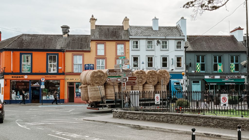
Day 2: Waterville to Cahersiveen (the Skellig Ring)
- Ballinskelligs Beach: 20-minute stop
- Skelligs Telescope Viewpoint: 10-minute stop
- Skelligs Chocolate Factory: 15-minute stop
- St. Finian’s Bay: 10-30 minute stop
- Kerry Cliffs: 1.5-2 hours (a good place to linger)
- Lunch at Kerry Cliffs, Portmagee, or Skellig Experience Visitor Center: 15 minutes-1 hour. If you’re short on time, grab a toastie from the Kerry Cliffs or the Skellig Experience
- Skellig Experience Visitor Center: 20-30 minute stop
- Bray Head Loop: 1-2 hour stop
- Geokaun and Fogher Cliffs: 30-minute stop
- Dinner in Cahersiveen: as long as you’d like
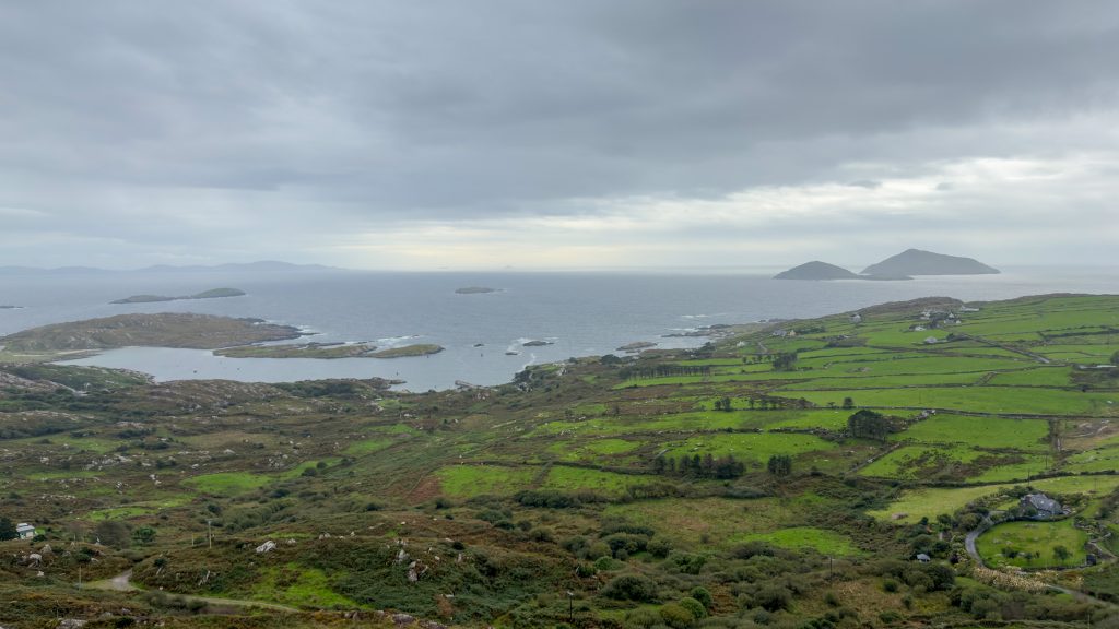
Day 3: Cahersiveen to Killorglin (then off to Dingle or back to Killarney)
- Cahergal Cashel: 20-minute stop
- Cuas Crom Beach: 30-minute stop (longer if you want to do the sauna and sea swim)
- Rossbeigh Beach: 1 hour stop
- Cromane Beach: 45-minute stop
- Killorglin: 30-minute stop or skip it and drive through town
After leaving Killorglin, you will either continue to Dingle or return to Killarney.
As this article moves into the detailed description of each day, I’ll share driving times. Please know that these are estimates and based on Google Maps.
I also rounded up because I’ve noticed that driving around Ireland generally takes a bit longer than Google Maps estimates due to traffic (yep, I’ve been stuck behind sheep and tractors), construction, and weather.
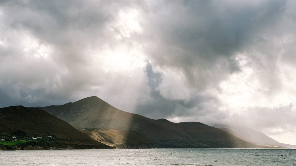
Day 1 Killarney to Waterville
Welcome to day one on the Ring of Kerry!
Today, you’ll leave Killarney and head to Waterville, stopping at mountain viewpoints, a charming town, ancient stone sites, and one of my favorite beaches in Ireland.
My two favorite stops were Kenmare Stone Circle and Derrynane Beach. The first was a peaceful, unexpected discovery, and the latter a coastline I could have spent hours exploring.
The drive is approximately 93 km (57 miles) and takes around two hours without stops. But with viewpoints, lunch in Kenmare, and time to explore along the way, plan to spend the whole day on this section of the Ring of Kerry.
Day 1 at a glance
- Start: Killarney
- Finish: Waterville
- Distance: Approximately 93 km (57 miles)
- Time to allow: 6-8 hours
- My favorite stops: Kenmare Stone Circle and Derrynane Beach
- What to skip if you’re short on time: Don’t stop in Sneem. Possibly Staigue Stone Fort, but then you HAVE to go to Cahergal Cashel on day 3
- Where to stay: Kielty’s B&B in Waterville
Ladies View
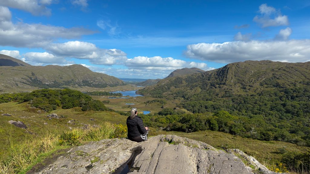
Your first stop is 23 minutes out from Killarney at Ladies View, a gorgeous viewpoint over Killarney Lakes.
It gets its name from Queen Victoria’s ladies-in-waiting, who visited this viewpoint during the Queen’s 1861 visit.
As you drive up, you’ll see a cafe and gift shop on the left and a car park overlooking the view to the right. There is seating at the top of the cafe if you want to enjoy a cup of tea there with the view. I opted for a bowl of soup with the view.
Just up the road is a better viewpoint that offers a 180-degree view from Lord Brandon’s Cottage all the way down to Killarney.
If you’re not staying for a meal, allow 15 minutes to enjoy the view and take some photos.
Moll’s Gap
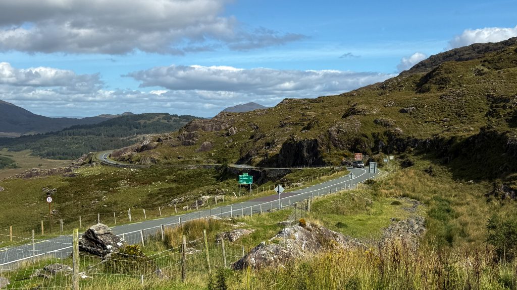
Moll’s Gap isn’t really a destination; it’s a journey (hehe). It’s a winding mountain road that starts after leaving Ladies View. The drive takes about 10 minutes, and the road isn’t as narrow as others you’ll encounter, so you can enjoy the drive and the views without too much stress.
There is a viewpoint for Moll’s Gap in a parking lot across the street from Avoca Cafe, which is also a great spot for unique souvenirs or a restroom break.
Kenmare Stone Circle
About 15 minutes from the Avoca Cafe, you’ll enter Kenmare, where you can visit the Kenmare Stone Circle.
I almost skipped the Kenmare Stone Circle, and I am so glad I didn’t. It’s an enjoyable 10-minute walk from Kenmare’s main street, and you pass beautiful Victorian homes and old barns with animal paintings along the way.
There is a suggested donation of €2.50, and with that you get a little card to write a wish. I wasn’t sure what the ticket taker meant by this at first.
The stone circle sits in the center of a tree-covered outcropping overlooking the river, and it’s incredibly peaceful. I’m glad I was the only one there because I got emotional when I first saw it. This happens a lot for me when I’m in Ireland.
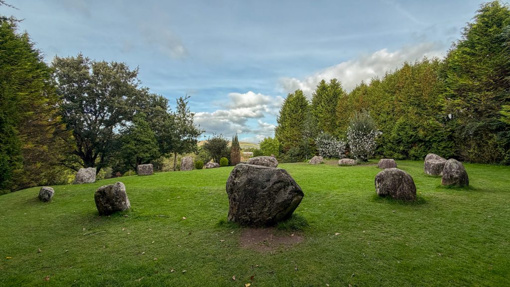
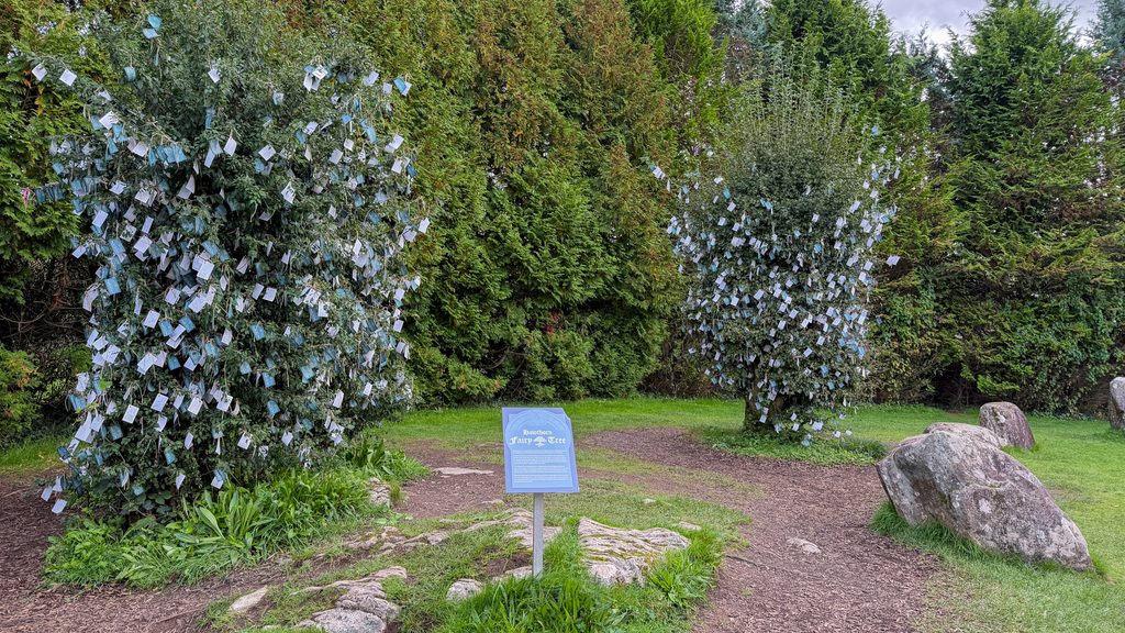
To the left of the circle are a few Hawthorne Trees, which are important in Irish culture and folklore. Also known as the Fairy Tree, for the fairies call it home, and these trees symbolize love and protection.
Cutting down a Hawthorn Tree is believed to bring bad luck, so much so that roads are built around them, and if they’re on your property, you leave them be. They’re often found next to ancient places, like stone circles.
People leave prayers and gifts at these trees for good fortune. These tree branches were covered in cards, hence the suggested €2.50 donation, holding visitors’ hopes and wishes. Mine joined them.
Don’t skip this site; it doesn’t take much time, and it’s somewhere I didn’t think I’d enjoy as much as I did.
If you’re not walking from town, a small parking lot is next to the entrance.
Kenmare
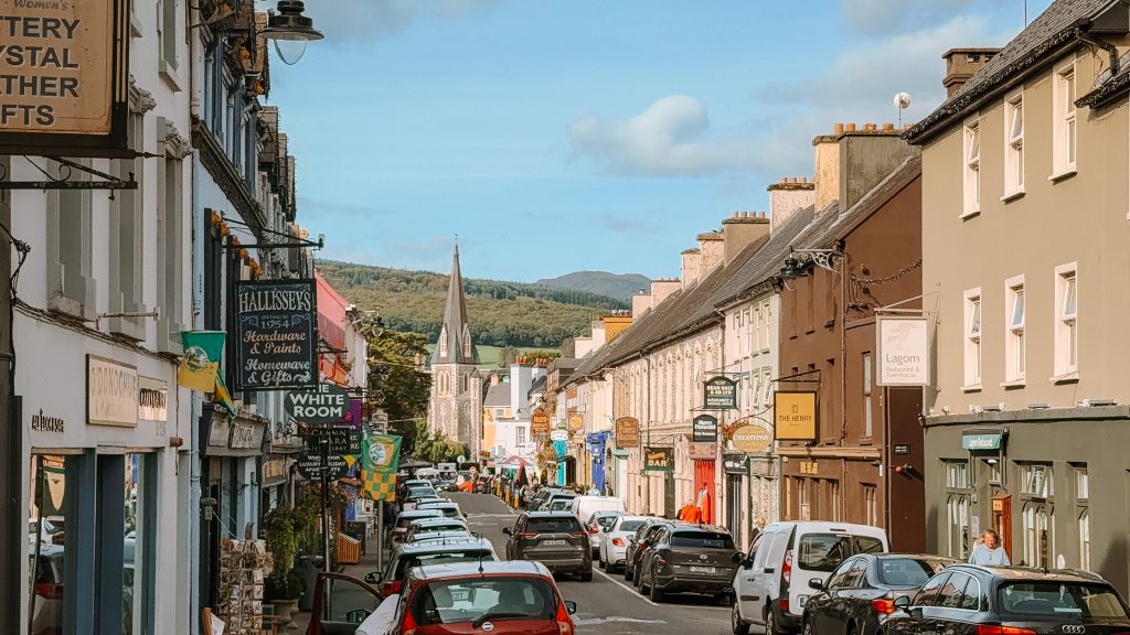
Kenmare is a buzzing town, and the first town you’ll reach on the Ring of Kerry after leaving Killarney. It’s fairly touristy, but filled with great restaurants and pubs, most of which have live music nightly.
Stop here for lunch at Kenmare Brewhouse. If you’re not quite hungry yet, grab a sweet treat and tea or coffee from Blasta.
Where to Stay in Kenmare: DaVitt’s Bar & Restaurant
While this itinerary doesn’t include an overnight in Kenmare, it is a good option to stay for one night so you can enjoy the pubs and lively atmosphere before starting the rest of the Ring of Kerry. I stayed at DaVitt’s Bar and Restaurant, which included breakfast.
Sneem
The next town you’ll encounter is Sneem. The drive between Kenmare and Sneem takes about 30 minutes and is not super pretty, so there’s nowhere really to stop in between.
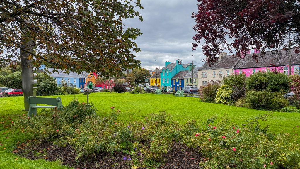
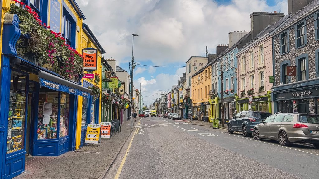
Sneem is a colorful and bright small town that doesn’t feel overly touristy. You can easily find parking to go for a quick stroll through town. I noticed it was mostly locals, a stark contrast to the heavy tourist crowd in Killarney and Kenmare.
You could stay here for a quieter night than in Kenmare; otherwise, it’s a good spot for a quick snack from the Bridge Cafe.
If you’re feeling short on time, you can simply drive through Sneem.
Staigue Stone Fort
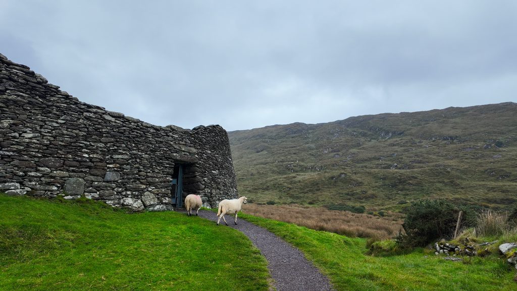
30 minutes from Sneem, you’ll visit another ancient site: the Staigue Stone Fort. It is one of the largest intact Iron Age stone forts, built sometime around 300-400 BCE!
The fort was built without mortar, using smaller stones mixed with larger ones to create a structure that has lasted for centuries. It’s amazing to see, and the views are beautiful. You may also see a few rogue sheep.
It’s about a 20-minute detour from the Ring of Kerry on very narrow roads, but I think it’s worth the adventure. That being said, if you’re feeling short on time and want to prioritize beaches or visit Derrynane House (which I didn’t do), then skip it.
There is a parking lot with toilets and an honesty box for payment.
Derrynane Beach
Your next stop is roughly 25 minutes away and my favorite of the day: Derrynane Beach. Derrynane Beach is a large white sand beach that my local friend said I absolutely must visit. When a local says to do something, I pay attention.
At one end of the beach, large rocks form tidal pools at low tide, and at the other end, a 6th-century abbey sits on what’s technically an island called Abbey Island!
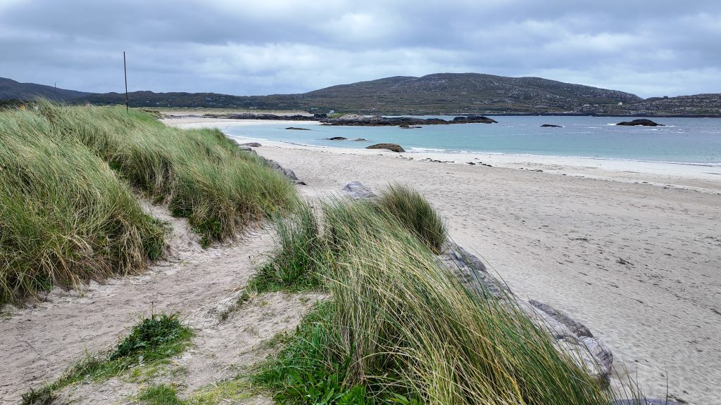
At low tide, you can walk the entire length of this beach to Abbey Island. If not, you can drive to a closer parking lot and walk from there.
The cemetery overlooking the turquoise water is quite something, and you also get great views of the two beaches backing up to each other.
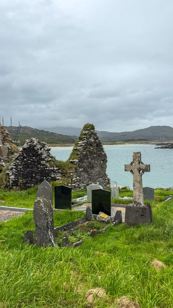
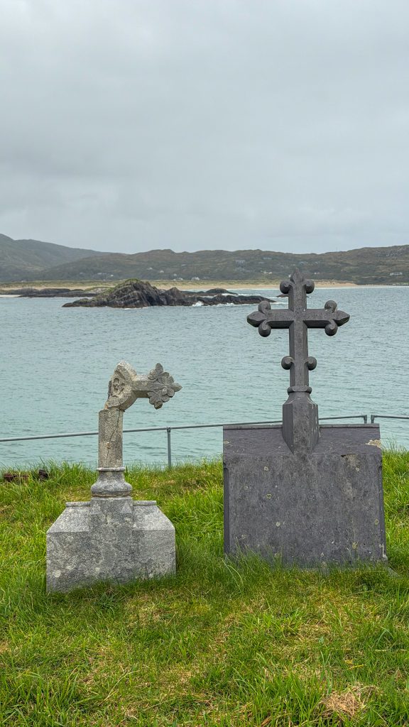
I spent about two hours at this beach, walking its full length and then enjoying the coastline view from Abbey Island.
Parking lots are available at both Abbey Island and Derrynane Beach. At Derrynane Beach, there are also public restrooms just behind the car park.
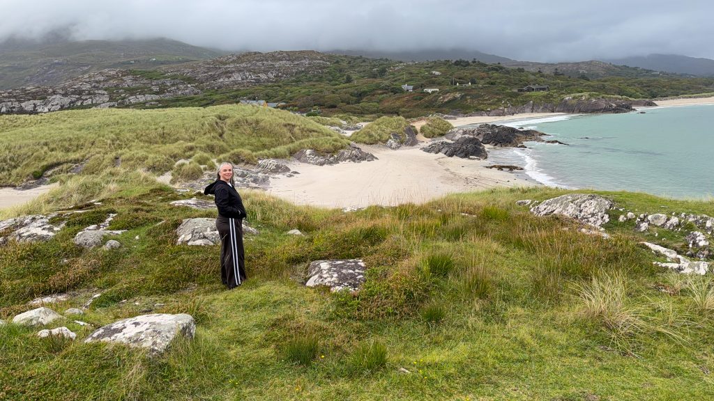
The beach is just down the road from Derrynane House, where Daniel O’Connell spent part of his childhood. I didn’t visit the house, but if that period of Irish history interests you, it’s worth checking out.
Dinner & Overnight in Waterville
From Derrynane Beach, it’s about a 20-minute drive to Waterville, where you’ll spend the night. The road has a few viewpoints along the way if you want to stop and enjoy them!
As I pulled into town, I noticed it was pretty quiet, and many main-street storefronts were vacant.
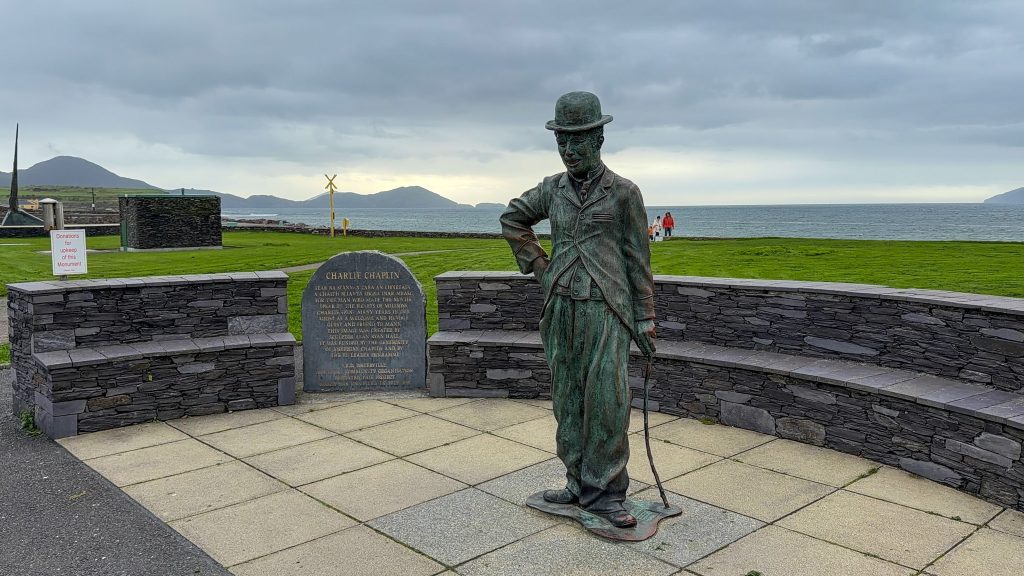
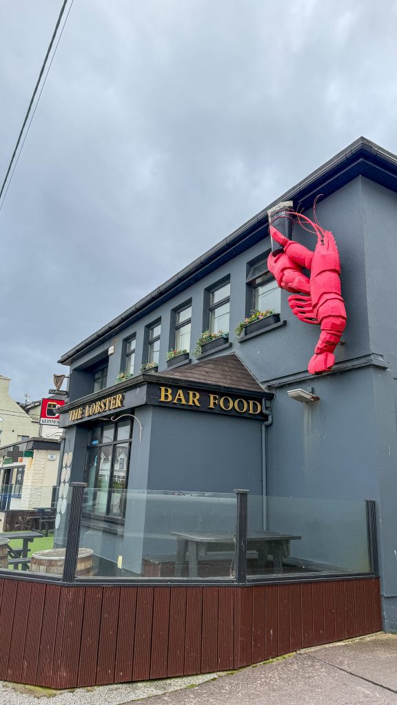
After walking along the waterfront for a bit and snapping a photo of the Charlie Chaplin statue (Waterville is where Charlie Chaplin’s family vacationed in the 1950s), I went to the Lobster Bar and Restaurant for dinner.
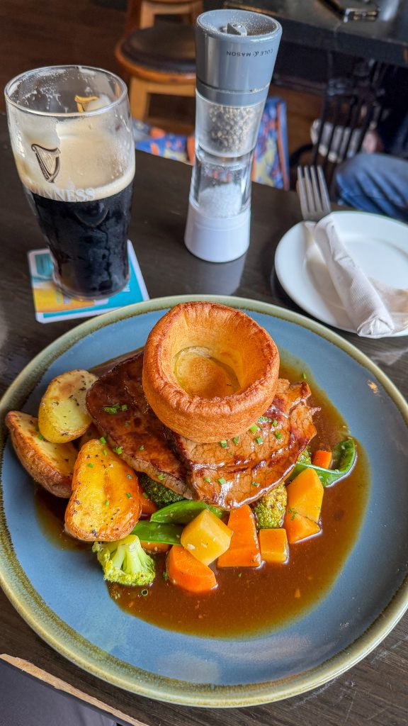
Although there was no lobster on the menu, I had one of the best roast dinners, complete with a Yorkshire pudding. After a delicious meal, I sat there and read my book for a few hours before checking in to my Airbnb.
Waterville is where you’ll leave the Ring of Kerry to join the Skellig Ring, heading towards Ballinskelligs Beach.
Where to Stay in Waterville: Kielty’s B&B
Kielty’s B&B is just a few minutes’ drive from Waterville’s main street. Kielty’s offered a welcome reception after a long day of driving.
The room was large, and before bed I dropped my breakfast order off downstairs so it was ready when I went down in the morning. They also offered a to-go lunch, which I thought was a nice touch!
Check rates and availability here.
Day 2 Waterville to Cahersiveen (The Skellig Ring Itinerary)
Today is the highlight of the entire drive!
You’ll leave the official Ring of Kerry route and follow the Skellig Ring drive, a spectacular 50 km (30-mile) extension along the Iveragh Peninsula. This detour is absolutely worth the time, with white-sand beaches, dramatic cliffs, and stunning views of Skellig Michael.
On Google Maps, the drive takes about an hour and a half without stops, but plan for 7–8 hours (possibly more) to explore. I left Waterville at 9:00 am and arrived in Cahersiveen at 4:30 pm, including a 3-mile hike and extra time at the beaches.
Your day may take longer depending on how much time you spend at each stop and how long you wait for the car ferry.
If you’re anything like me, you may find it hard to leave some of these places!
Add the Skellig Ring stops to Google Maps before you set off. Otherwise, it may send you back onto the main Ring of Kerry route, and you’ll miss this incredible detour.
Today, the weather can make a big difference to the views, especially on Valentia Island and at the Kerry Cliffs.
Check the car ferry’s operating times before you go, since you’ll use it to cross from Knightstown to Cahersiveen at the end of the day.

Day 2 at a glance
- Start: Waterville
- Finish: Cahersiveen
- Distance: Approximately 50 km (30 miles)
- Time to allow: All day
- My favorite stops: Kerry Cliffs, St. Finian’s Bay, Skelligs Chocolate, and Bray Head
- What to skip if you’re short on time: It’s hard to choose, but I’d skip Skellig Experience, especially on a nice day, to spend more time at Bray Head.
- Where to stay: This Airbnb in Cahersiveen
Ballinskelligs Beach
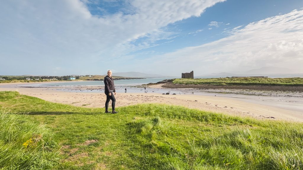
Stop one today is Ballinskelligs Beach, a 15-minute drive from Waterville and a must-visit for a morning beach walk. A 16th-century castle, aptly named Ballinskelligs Castle (or McCarthy Mór Castle), sits on a promontory at one end of the white-sand beach.
This tower house was used to charge tariffs on incoming ships and is related to another tower house on the Ring of Kerry, Ballycarbery Castle.
You can walk up to it and explore it if you like! I did not, preferring to enjoy the view from just above the beach.
There is a large parking lot and public toilets available here.
Skellig Michael
After leaving Ballinskelligs Beach, plot “Skelligs Telescope Viewpoint” into your Google Maps for the first sighting of Skellig Michael. It’s an 8-minute drive, and there is a small space to park along the roadside here.
8 miles off the Skellig Ring are two rocky islands called Skellig Michael, one of Ireland’s UNESCO World Heritage Sites.
Monks created a monastic settlement there which included beehive huts that were used as dwellings, an oratory for worship, a church, and a graveyard.
More recently, Skellig Michael was a filming location for Star Wars movies, which my brothers will tell you they’re ashamed I haven’t watched, so I can’t tell you which movie or scenes in particular.
I did pay to use the telescope to try to get a closer view of the islands, but it didn’t work. So maybe pack binoculars?
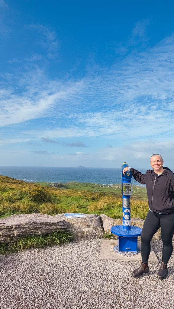

You can visit the islands via very limited boat tours. Landing tours require you to climb 618 steps to reach the monastery. If that doesn’t sound like something you’re up for, you can take an eco boat tour that doesn’t land but circles the islands.
These tours run in the summer months and are heavily dependent on weather and sea conditions. I booked my tour for September 25th, and it was canceled because of poor sea conditions.
I asked my friend who lives in Kerry if she’s done the landing tour. She hasn’t either, but she’s done the eco boat tour and told me that you can see the monastery, the beehive huts, and puffins (in specific months) from the boat.

If you can secure a booking, the eco tour will take about 2.5 hours, while the landing tour will take 5 hours. Which means you may have to skip portions of this day or reorganize it based on the tour times.
This tour remains on my Ireland bucket list and is just another reason to return!
On a clear day, you will be able to see the islands as you drive the remainder of the Skellig Ring and from the Kerry Cliffs, so if you miss this specific viewpoint, don’t worry, you’ll see them all day long!
Skelligs Chocolate Factory and Cafe
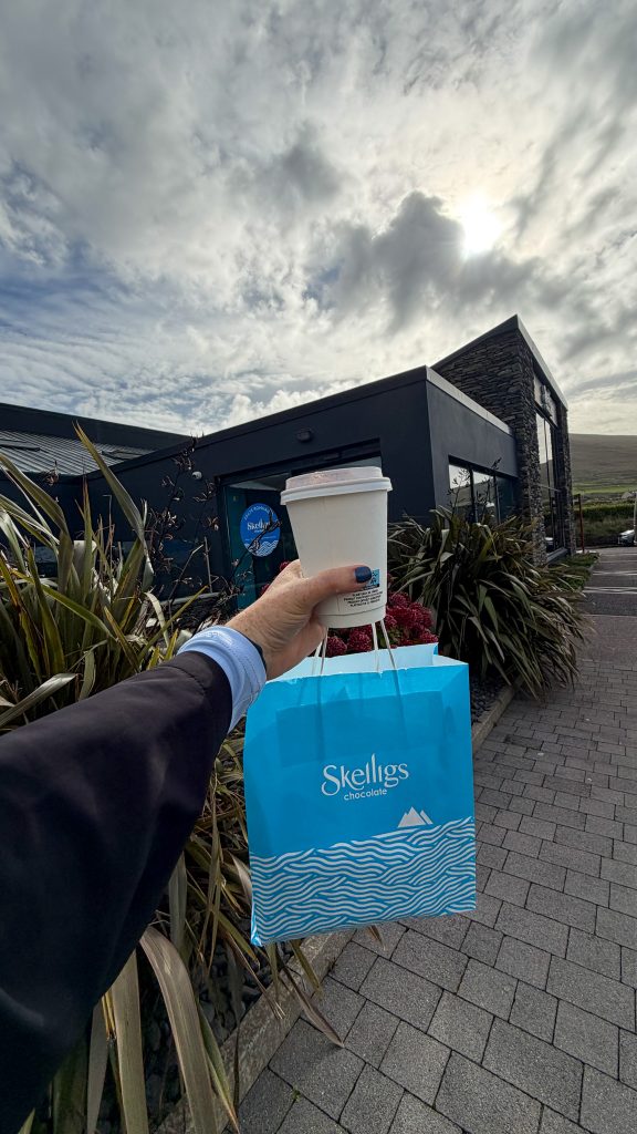
Just 5 minutes down the road is the Skelligs Chocolate Factory and Cafe, which you should definitely stop at to sample their chocolate, see it in production, buy some tasty souvenirs, and enjoy a hot chocolate.
I don’t enjoy white chocolate, typically, but they have a lime white chocolate that is so unique and delicious. It’s almost like a palate cleanser. I bought it for my office, and it was a hit amongst my coworkers!
I was the only person in the shop when I arrived, getting there just before a small tour van showed up, so the visit took about 20 minutes, but if I’d been behind the group it might have been a bit longer!

St. Finian’s Bay
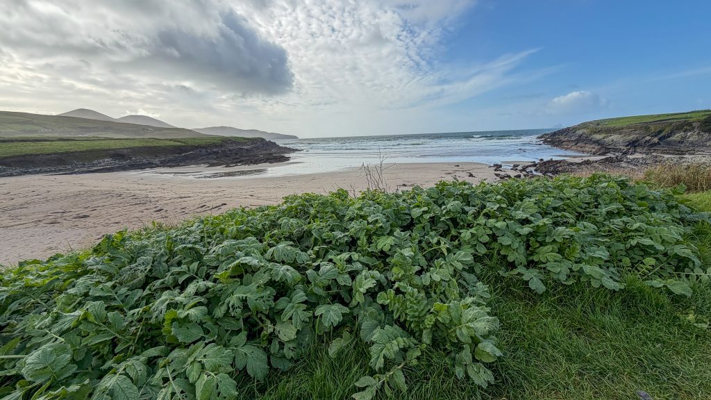
Less than a minute’s drive from the chocolate shop is St. Finian’s Bay, a small cove beach with excellent views of Skellig Michael.
It has a small parking lot, and it’s worth stopping to walk around and enjoy the views.
Across the street is Driftwood Cafe, which I’d planned to eat at for lunch, but it had just closed for the season. So I can’t speak to the food quality, but the views would be spectacular. If it’s open, stop here for lunch with a view before continuing to the Kerry Cliffs.
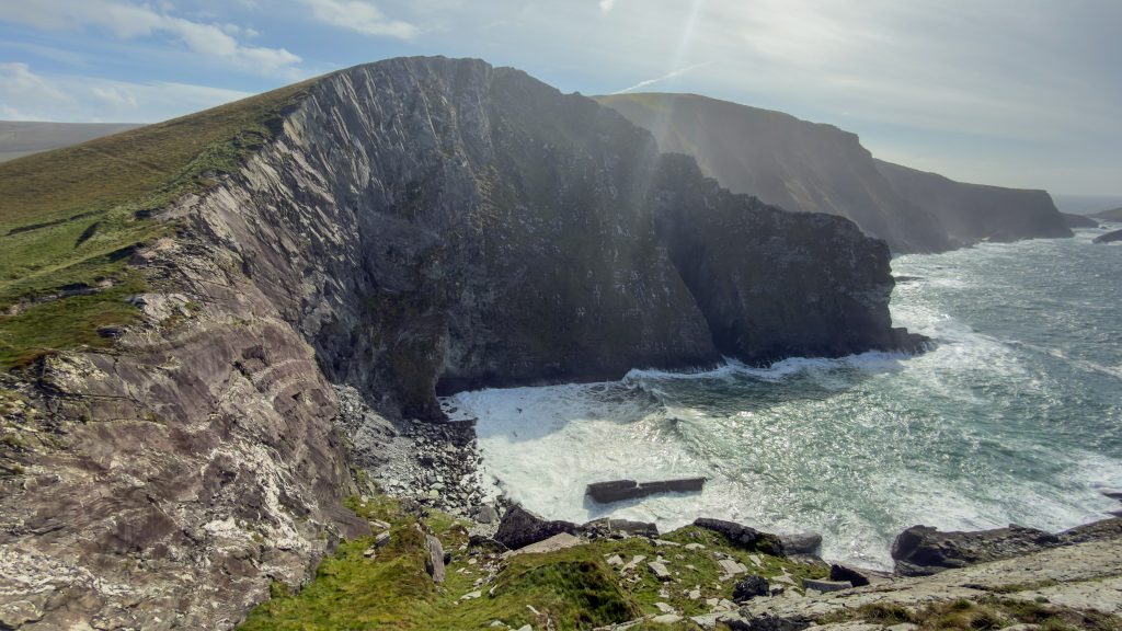
Kerry Cliffs
15 minutes down the road are the most spectacular cliffs in Kerry, the Kerry Cliffs. At least that’s what the signs say as you get closer.
I parked, used the restroom, and paid €5 to climb the fairly steep hill past alpacas and donkeys to find out if this claim was true!
I mean, they do have a lot of competition against the Cliffs of Moher and Slieve League Cliffs.
As I reached the Wild Atlantic Way sign, I looked out to the Atlantic Ocean and saw the Skellig Islands as the wind whipped through my hair. To my left, the cliffs rose even higher.


I took a deep breath of the wild sea air and walked to the right to view the higher peak and Puffin Island (a green island just below the cliffs).
Then I made a fairly steep climb to the left, just below the highest point at 1,000 feet above sea level.
There is a photo opp here which a “girl dad” helped me with, making sure I was positioned correctly so I wasn’t blocking the Skellig Islands.
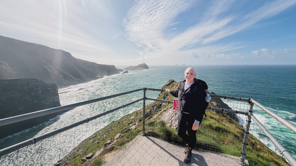
After an hour of taking in the views, I took my wind-blown booty back down the hill for a cup of tea and toastie from the food stand.
Yes, the cliffs really are spectacular.
Yet, my favorite Irish cliffs remain the Slieve League cliffs in Donegal.
Portmagee
Portmagee is a small fishing village just 5 minutes down the road from the Kerry Cliffs where boat tours depart to the Skellig Islands.
A few harbor-front pubs line the waterfront, so it could be a good lunch stop.
I didn’t stop in Portmagee, but I would stay here on a return trip as a base for the Skellig boat landing tour.

Valentia Island
Valentia Island is connected to the mainland via a bridge from Portmagee. There’s plenty to do on the island, like visiting the Skellig Experience, hiking Bray Head, and enjoying the views from Geokaun Mountain.
If the weather’s good, it’s worth visiting the island for the spectacular views. But if it’s foggy or rainy, it might be better to skip it because you won’t be able to see them! If the weather is bad, have a leisurely lunch in Portmagee and go to the Skellig Experience.
The weather could clear up by then. If not, head to Cahersiveen. You may be able to visit some of the sites on day 3 instead or just enjoy the evening in town. If you really want to see Valentia Island, you could try the following day again, taking the car ferry both ways to save time!
But I am going to assume you have good weather and explain what to see on Valentia Island!

Skellig Experience Visitor Center
Since I didn’t get to take a boat out to the Skellig Islands, I stopped at the Skellig Experience, which is just over the bridge from Portmagee.
The small visitor center costs €6 and lets you learn about the islands’ history, the nearby lighthouse, and life in this corner of Ireland. I kind of speed-ran through the exhibits because I wanted to hike Bray Head.
It has toilets (free to use) and a cafe.
The view across the water to Portmagee from here is also a great photo opportunity.
Bray Head Walk
After leaving the Skellig Experience, drive 5 minutes to the Bray Head Trail parking lot.
AllTrails lists the Bray Head Loop Trail as a 3-mile loop, but it’s actually an out-and-back trail along the stunning coastline of the Iveragh Peninsula.

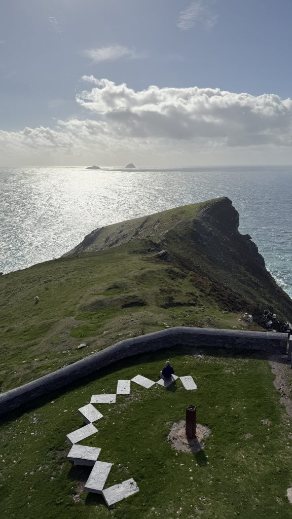
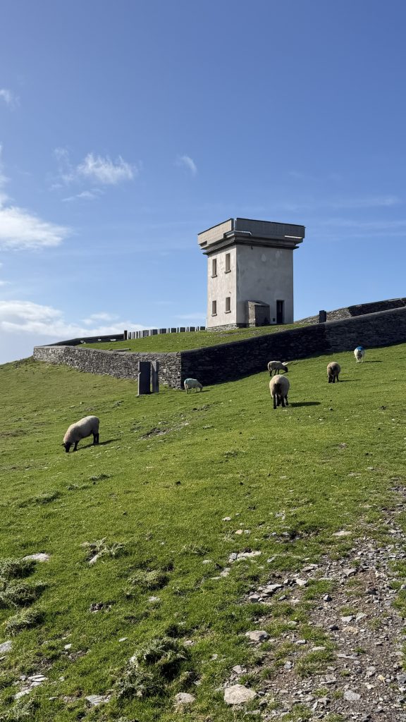
As you walk the 1.5 miles up the steady incline to the Bray Head Signal Tower, you’ll have views of Skellig Michael almost the entire way!
When you reach the tower, there is a bench to rest and enjoy the views of the Kerry Cliffs in the distance.
Climbing to the top of the tower gives 360° views of the peninsula, including the Great Blasket Islands, Skellig Michael, Kerry Cliffs, and Geokaun Mountain. This is, of course, if it’s a clear day.
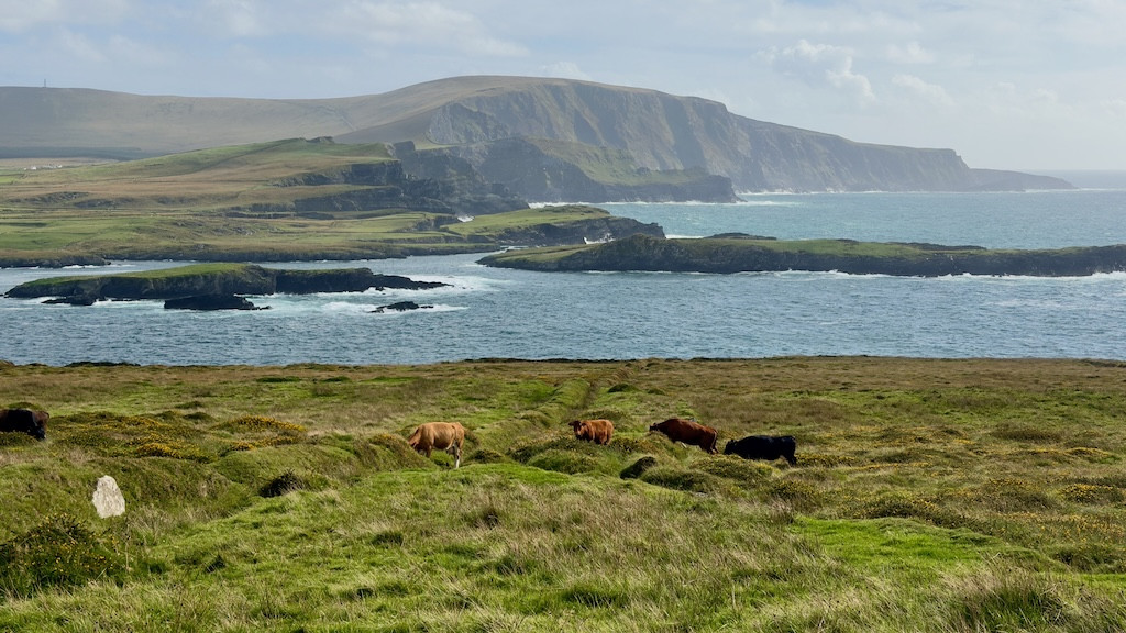
On the way back down to the parking lot, you’ll have sweeping views of the distant mountains, Portmagee, the bridge to Valentia Island, and vibrant green fields.
You may pass cows or sheep. If you have a dog, keep it on a leash.
If it’s foggy or incredibly rainy, you could wait a few minutes to see if the weather changes, but if it doesn’t, I would skip it because you won’t be able to see anything.
Parking is €2 and payable in coins only. Display the parking ticket on your dashboard.
Geokaun Mountain and Fogher Cliffs
After the hike, drive 15 minutes to the top of Geokaun Mountain, stopping at Fogher Cliffs on the way. You will need to pay to access this at a small ticket booth when you enter.
The first stop after the ticket booth is Fogher Cliffs. There is a short walk from the parking area to the lookout point, which offers views of the tall sea cliffs, Bray Head, and across to the Dingle Peninsula.

Afterward, drive to the top of Geokaun Mountain, where you can see Valentia Lighthouse and the mountains in the distance. It’s a beautiful view. It is very windy at the top, but there is a 1.5-mile loop you can walk. I opted out because of the wind, and I had to get to dinner!
Technically, you can also walk to the top of the mountain, but I don’t think it’s necessary. It’s just a very steep paved road. Take a break and drive up!


Cahersiveen
From the top of Geokaun Mountain, head 15 minutes to Knightstown to board the car ferry to Cahersiveen for the night.
The Valentia Island Car Ferry to Cahersiveen saves about 30 minutes of driving.
The car ferry doesn’t have a strict departure schedule; since it takes only 5 minutes to cross, it runs back and forth throughout the day. But check its first and last departure times throughout the year so you don’t miss it!

You don’t need to pre-book. You’ll pay when you board.
I’m not sure why, but Google Maps doesn’t show the car ferry that connects Knightstown on Valentia Island to Cahersiveen, but I promise it’s there and super easy to navigate.
Cahersiveen is a lively town and a good place to rest for a night or two after driving the Skellig Ring and Valentia Island. Frank’s Pub is a good spot for dinner and drinks; there’s an ancient ring fort with castle views, plus a sauna on a beautiful beach which you’ll visit tomorrow!
Where to Stay in Cahersiveen: Airbnb
I stayed at this Airbnb a few minutes’ drive from Cahersiveen’s main street. I chose it because it had laundry, which I knew I would need at this juncture in my two-week trip to Ireland.
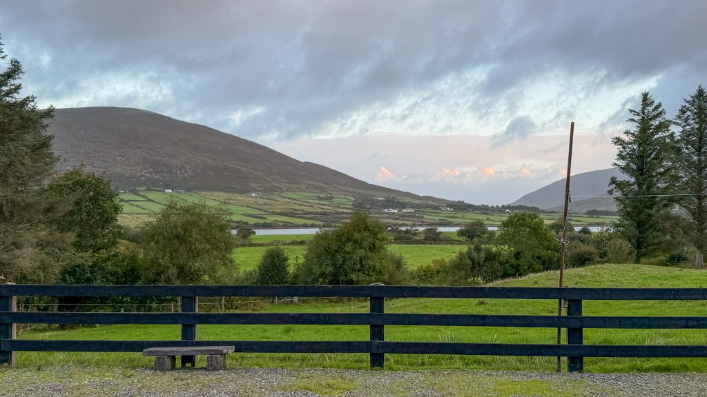
It was a really nice space, behind someone’s home, with views of fields, the water, and mountains. The host also provided a half loaf of bread, snacks, milk, and plenty of tea, which I thoroughly enjoyed!
Day 3 Cahersiveen to Killorglin (then off to Dingle or back to Killarney)
Today is your final day on the Ring of Kerry! You’ll start by visiting two ancient sites near Cahersiveen, then spend most of the day hopping between beautiful beaches.
The drive from Cahersiveen to Killorglin is approximately 55 km and takes around an hour without stops. But with time to explore the forts, enjoy the coastline, and linger at the beaches, you can easily turn it into a full day.
Day 3 at a glance
- Start: Cahersiveen
- Finish: Killorglin (then return to Killarney or continue to Dingle)
- Distance: Approximately 55 km (34 miles)
- Time to allow: 5 hours to Killorglin (plus 1 hour to Dingle or 30 minutes back to Killarney)
- My favorite stops: Cahergal Cashel, Cuas Crom Beach, Rossbeigh Beach
- What to skip if you’re short on time: Ballycarbery Castle and Cromane Beach
- Where to stay: This hotel in Dingle
Once you reach Killorglin, you can return to Killarney to complete the full loop or continue toward Dingle.
I recommend continuing to Dingle if you have the time, especially if you’re planning to explore more of Ireland’s west coast.
From Killorglin, it’s about a 50-minute drive to Dingle without stopping.
But of course, I recommend stopping at Inch Beach on the way! There is an overlook for it if you just want a quick 5-10 minute stop, or you can park in the parking lot and go for a long walk that would take about an hour.
Cahergal Cashel
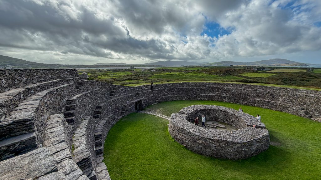
Back on the Ring of Kerry and just a 5-minute drive from Cahersiveen’s main street is Cahergal Cashel. This well-preserved stone ring fort dates to between 550 and 900 AD and was likely used as a defensive structure.
From the top of the fort’s walls, you can see Ballycarbery Castle and the Valentia River.
I liked this one more than the Staigue Stone Fort, because the center was still intact and the views were amazing. I’d make time for this 20-minute visit, especially if you like ancient sites.
Ballycarbery Castle
5 minutes down the road from Cahergal is Ballycarbery Castle, which was built by the McCarthys at some point in the 15th century.
I loved the ruins of this tower house. As I walked around it, I noticed trees had taken root in the stone gaps and grown strong ivy to the top. The views from the front of it to Cahersiveen are quite impressive as well.
As the castle is on private property, there is no official access point, and it took me a minute to find where I could enter. There is a small area for unofficial parking in front of it. You’ll see a few signs that say Private Property, and one that shares the castle’s history.
Only visit where access is permitted and obey posted restrictions; don’t cross private property to reach the ruins.
I don’t recommend walking into the castle because it is in quite a state of disrepair. This visit takes about 20 minutes.

Cuas Crom Beach
All the beaches along the Ring of Kerry are gorgeous, but my favorite is Cuas Crom Beach, a 10-minute drive from Ballycarbery Castle.
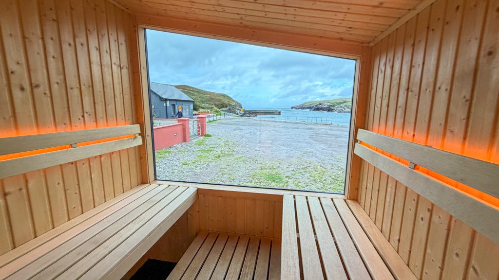
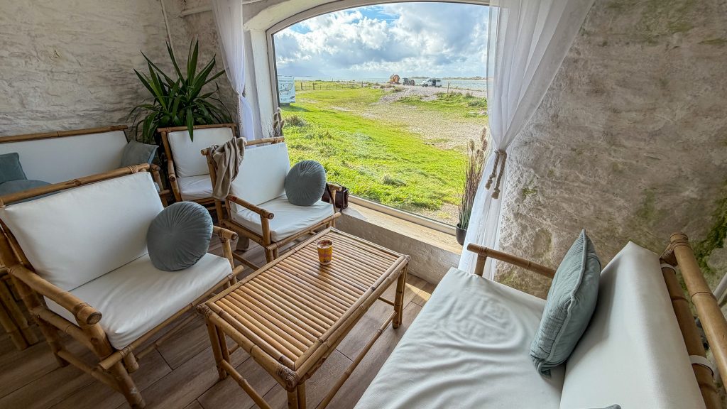
I loved it because it’s a small, sandy cove beach surrounded by green cliffs, and it has a sauna. I visited twice during my stay for a sauna and a sea swim. This is a ritual I am beginning to love when I visit Ireland.
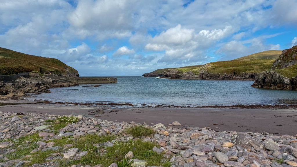
From the beach and the sauna’s large window, you can see across to the Dingle Peninsula.
If you’re interested in the sauna, check out Skellig Sauna. You don’t have to swim in the sea to cool off; you can take a cold plunge.
But if you can swim in the sea, do it! Floating in the frigid water, you’ll realize it’s not that cold once you’re in, especially as the sun beams down on you, which is quite special.
Plenty of parking, a public toilet, and a changing area are available after your swim.
Rossbeigh Beach
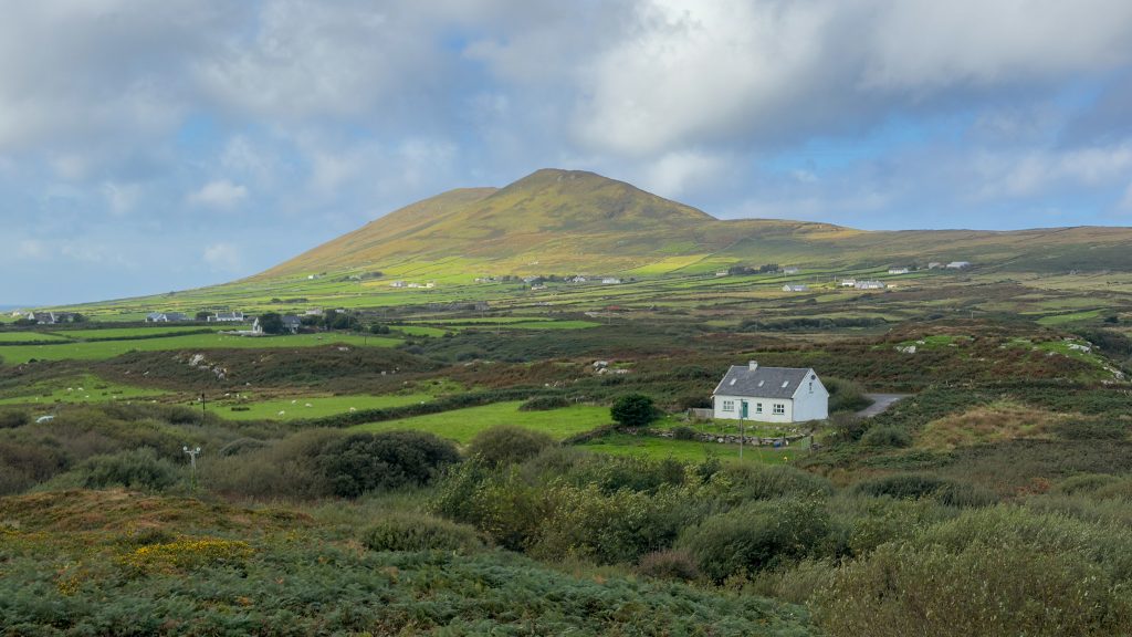
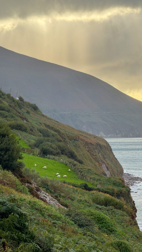
Rossbeigh Beach is 40 minutes from Cuas Crom Beach, and that drive is along a gorgeous road with coastal views to Dingle!
I’ll admit I was initially disappointed when I pulled into the Rossbeigh Beach parking lot. All of the Ireland travel blogs I read said this is one of the best beaches on the Ring of Kerry, yet I saw no sand. Only rocks.
I went to the restroom (yay for nice, clean toilets) and decided to walk toward the dunes anyway.
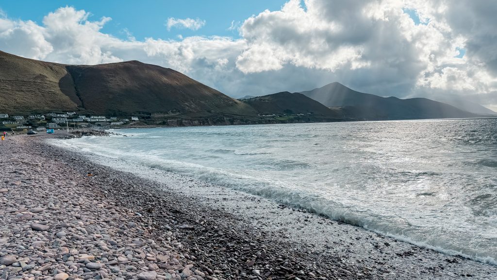
As I walked, I took a closer look at the rocks and noticed their pretty pastel pinks, blues, and browns. As the waves crashed, I heard a melodic sound as the water retreated over the rocks. Something I’d never heard at a beach before.
This is why you should go to Rossbeigh Beach. If the tide is in, you won’t get white sand here. But you will hear waves sing on the rocks framed by large green mountains looming in the distance. It is something quite remarkable.
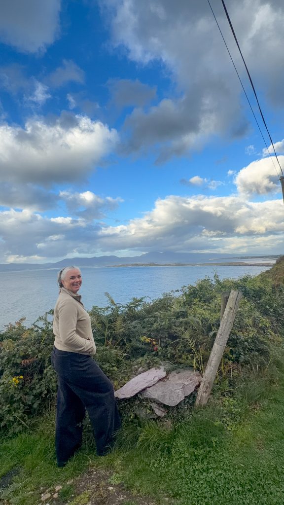
If you drive up the mountain road past Rossbeigh Beach, you’ll come to a right turn onto a local road. Park your car there and walk a bit for a nice overlook of the beach below. Google Maps will show it as Rossbeigh Beach Overlook.
Cromane Beach
Cromane Beach is 20 minutes from Rossbeigh.
I went to Cromane Beach on a stormy afternoon because I found a cafe right next to the beach. I ordered a toastie and hot chocolate, then sat by the large window overlooking the beach.
Someone was windsurfing, and there is a sauna here.
From the warmth of the cafe, I enjoyed the view of the back side of Inch Beach and beyond that, the Dingle Peninsula.
The cafe is called Boathouse Cafe and is definitely worth the journey.
That being said, the beach itself wasn’t my favorite of the trip. Maybe because it was a stormy, wild day, I didn’t really leave the cafe. It also has the same pastel pebbles as Rossbeigh Beach, so if you need to skip something, it’s this one.
Killorglin
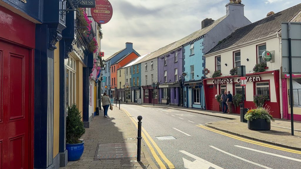
From here, your last town on the Ring of Kerry is Killorglin. This colorful town has lots of murals, good cafes, and a statue of a goat called King Puck. For at least 400 years, the town has held a festival in which a goat is brought down from the mountain and crowned King by a young girl, the Queen of Puck.
From an outsider’s perspective, it’s an interesting tradition, but the festival sounds like a great time!
Killorglin marks the end of the Ring of Kerry, sort of. From here, you’ll drive back to Killarney if you’re doing the full loop (Killarney to Killarney), or you can continue to Dingle (my preference).
Things to Do in Killarney Before Your Ring of Kerry Road Trip
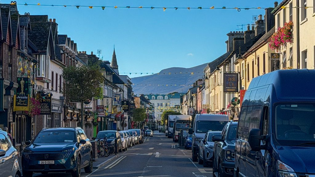
Killarney is considered the start and end of the Ring of Kerry. It’s home to the beautiful landscapes of Killarney National Park. From Killarney, you can walk the dramatic Gap of Dunloe valley and enjoy one of the many pubs, restaurants, or cafes in town.
Staying in Killarney for two days before you start the Ring of Kerry gives you time to explore the town, visit Killarney National Park, and walk the Gap of Dunloe.
I have an entire post dedicated to how to spend two days in Killarney, and I don’t think I need to re-share it all here. However, Killarney National Park is a part of the Ring of Kerry route, so let’s focus on that!
Killarney National Park
Killarney National Park is technically on the Ring of Kerry, but it takes at least half a day, so I recommend visiting while you’re in Killarney rather than waiting until you head out on the drive.
One of my favorite days I spent in Ireland was riding a bike through the park. If biking isn’t your thing, you can take a long walk through it or hop in a jaunting car to the spots below.
Here’s a quick overview of what to prioritize in Killarney National Park.
Ross Castle
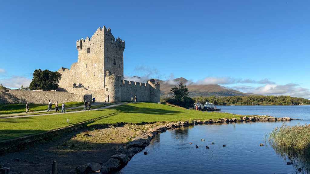
Ross Castle is a gorgeous 15th-century castle that overlooks Lough Leane. It might be my favorite place in Killarney National Park, especially at sunset! I like to walk there from town because the park’s landscape is stunning, and it’s a chance to spot a herd of Red Deer.
Muckross Abbey
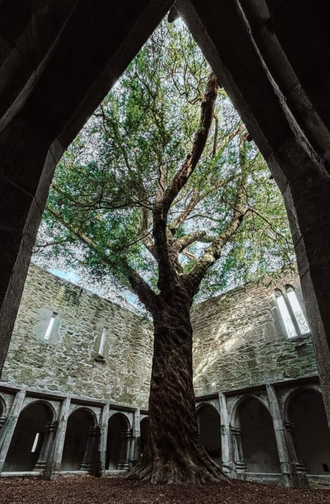
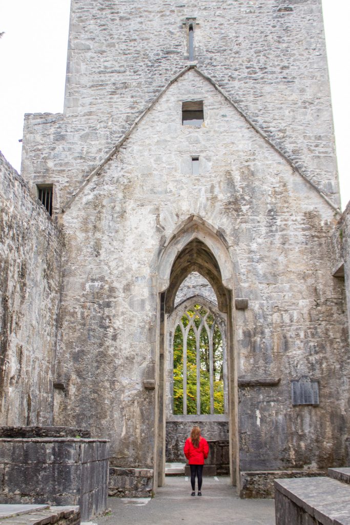
Muckross Abbey is a must-visit to see the ancient Yew Tree standing in the center of the cloisters. When I’m there, I like to imagine what the Franciscan monks who founded the Abbey would think of tourists traveling from around the world to visit and see the Yew Tree!
Muckross House
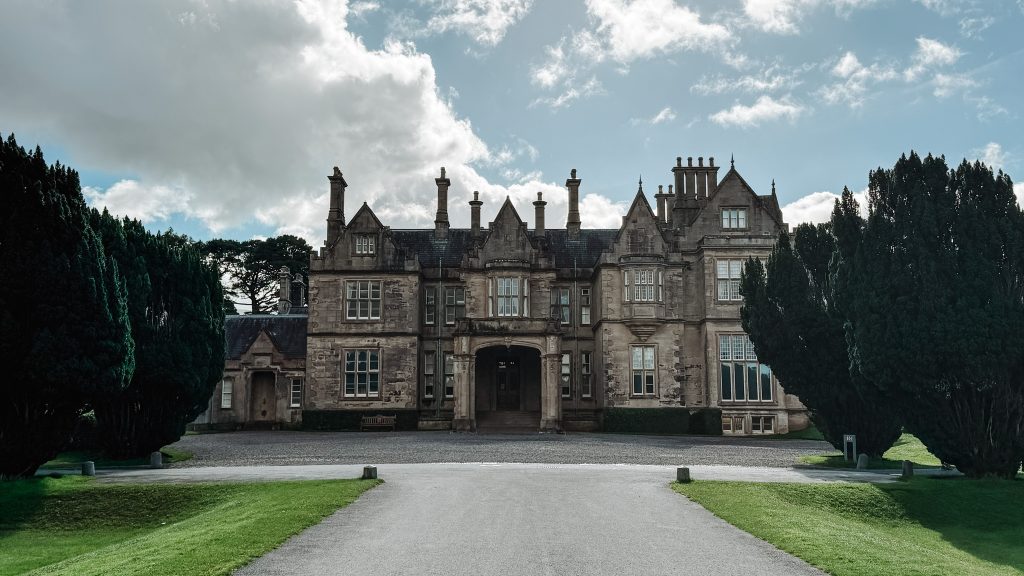
Muckross House is a large Victorian mansion that overlooks Muckross Lake. I enjoy walking the well-manicured gardens, but you can also take a self-guided tour inside the house (it costs €9). The view from the house to Muckross Lake is spectacular! Find a bench to enjoy it!
Torc Waterfall
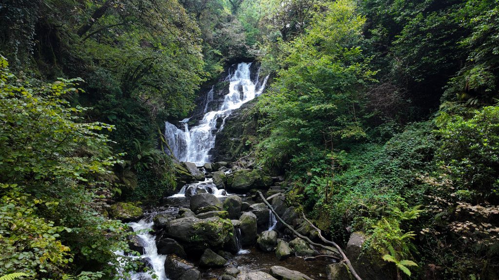
Torc Waterfall is a 20-meter-high waterfall that crashes over large boulders before its stream carries on into Muckross Lake. It’s a very popular spot in Killarney National Park, and it’s directly on the Ring of Kerry route, so it’s easy for people to pull over and walk to it within 10 minutes.
Even though it gets crowded, it’s a beautiful waterfall and worth a visit!
Where to Stay in Killarney: Algret House B&B
You’re spoiled for choice when it comes to accommodation in Killarney. I chose a cozy B&B about a 10-minute walk from town, with the kindest host and a delicious breakfast. Plus, my room at the front of the house had mountain views on clear days.
Check rates and availability here.
The Ring of Kerry is one of those road trips where the journey is just as memorable as the places you stop. With three days, you can experience many of the highlights without feeling like you’re racing from one viewpoint to the next.
Use this itinerary as a starting point, not a strict schedule. Choose the stops that excite you most, leave room for a few spontaneous moments, and don’t feel pressured to see everything. The best part of the Ring of Kerry may be the place you never planned to stop.
Remember to download my Google Map that includes all of these stops so that portion of the planning is done for you!
Continuing to Dingle? Read my Dingle itinerary to find the best stops, scenic drives, and things to do while exploring the peninsula.